DigAnalogic MAP
![]() Requirements:
Requirements:
During field surveys there is often a need for an overview that is only possible to have on the traditional paper medium: in this specific case, the complete road survey had to be quickly brought back to the map (with a pencil or a pen) to have an overview of the road trunks already surveyed and those yet to be surveyed.

 Solution:
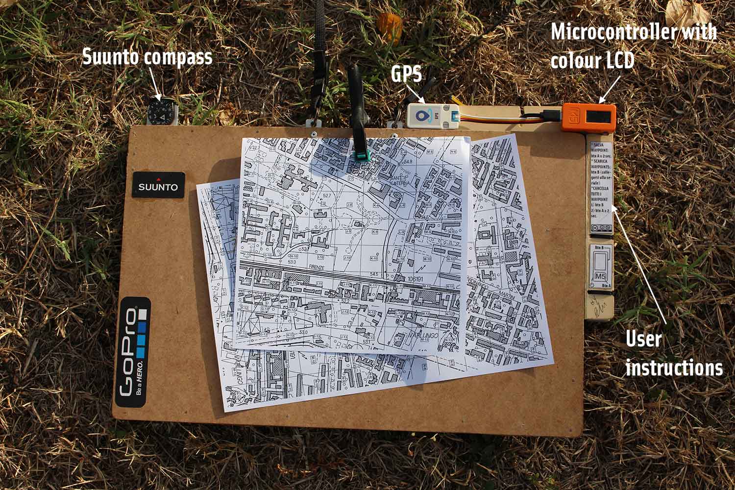
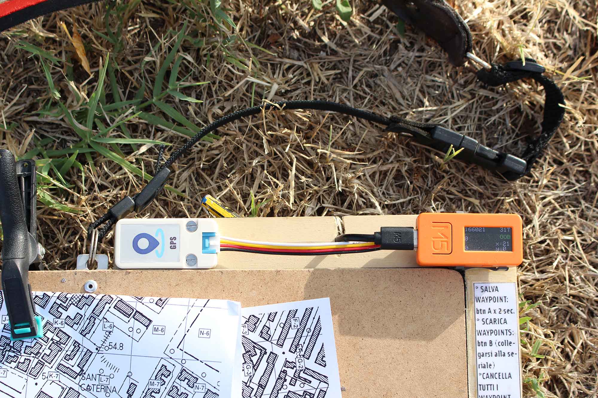
The solution is to be able to quickly locate one’s position on the paper map. Basically, the work area is divided into a mesh of squares (e.g., 100 m x 100 m or 1 km x 1km) each of which is assigned a unique identifier consisting of a letter and a number (“sea battle” system). The device shows the following information on the LCD display:
- which square we are in;
- the position within the square expressed in terms of Cartesian coordinates (X and Y expressed in meters).
Considering (e.g., of the 100 m x 100 m square) that half of the side of the square is 50 m and a quarter is 25 m, it is possible to locate our position on the map quickly and with good accuracy. Our positions can also be saved to the memory of the device and recalled at a later time to import them into programs such as Google Earth or a GIS (Geographic Information System).
Other informations reported on the device’s LCD are also the altitude and the coordinates in UTM format.

Specifications:
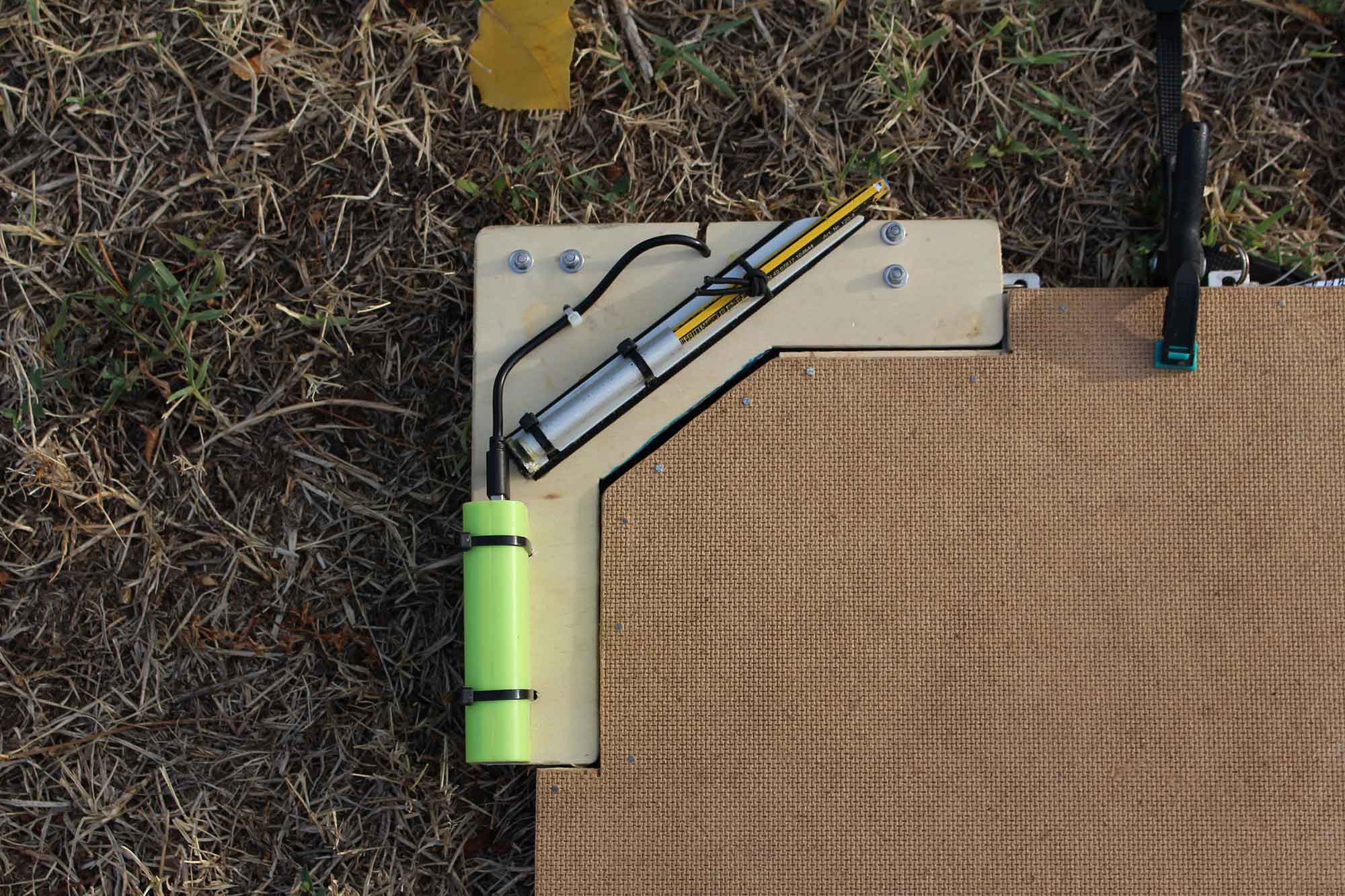
Weight: 950 g (including battery).
Dimensions: 45 x 30 cm.
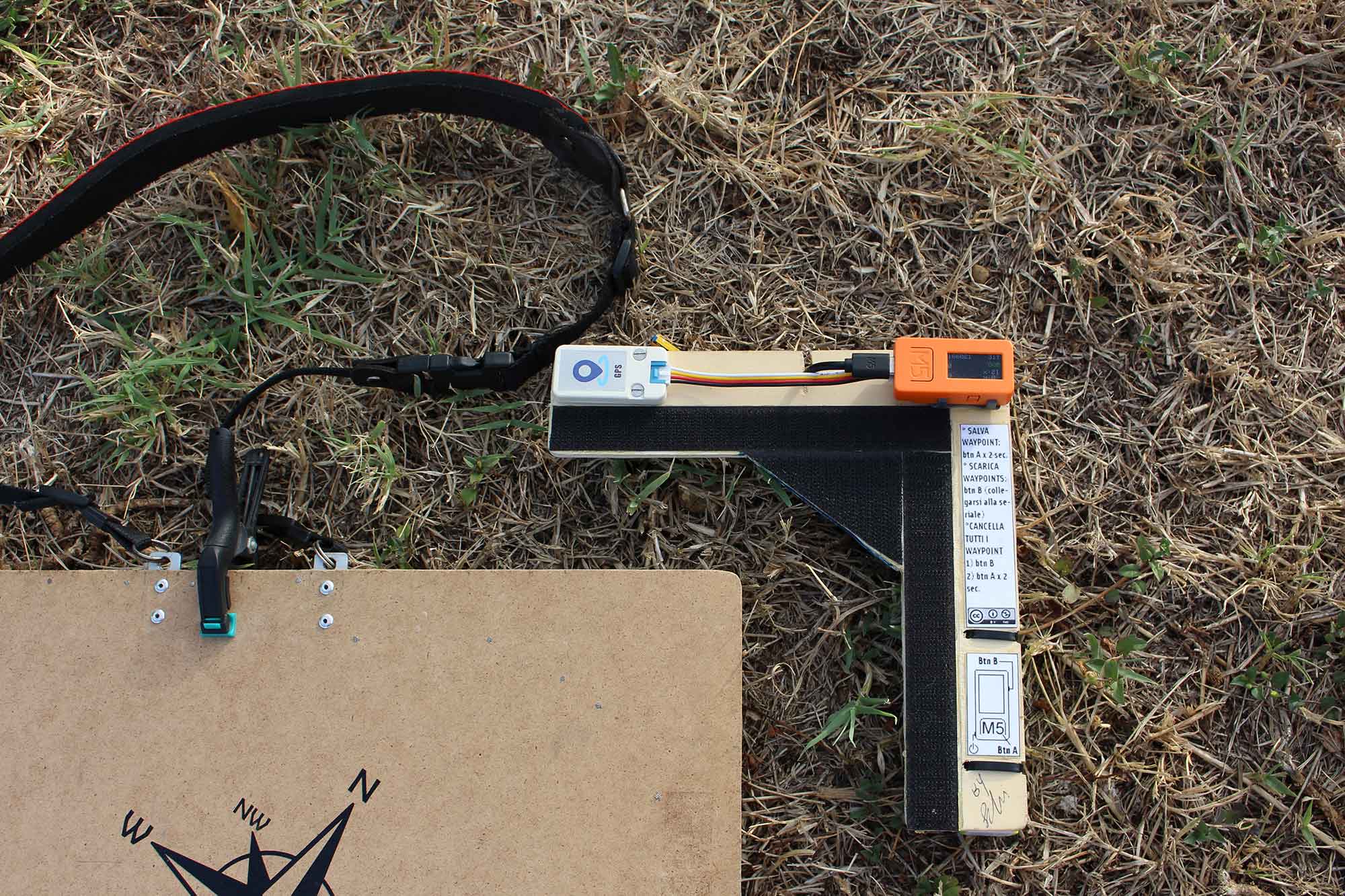
Sensor: GPS
Microcontroller: ESP32 Pico with LCD display (M5StickC or M5StickC Plus).
Connectivity: serial port or Bluetooth for downloading the recorded waypoints.
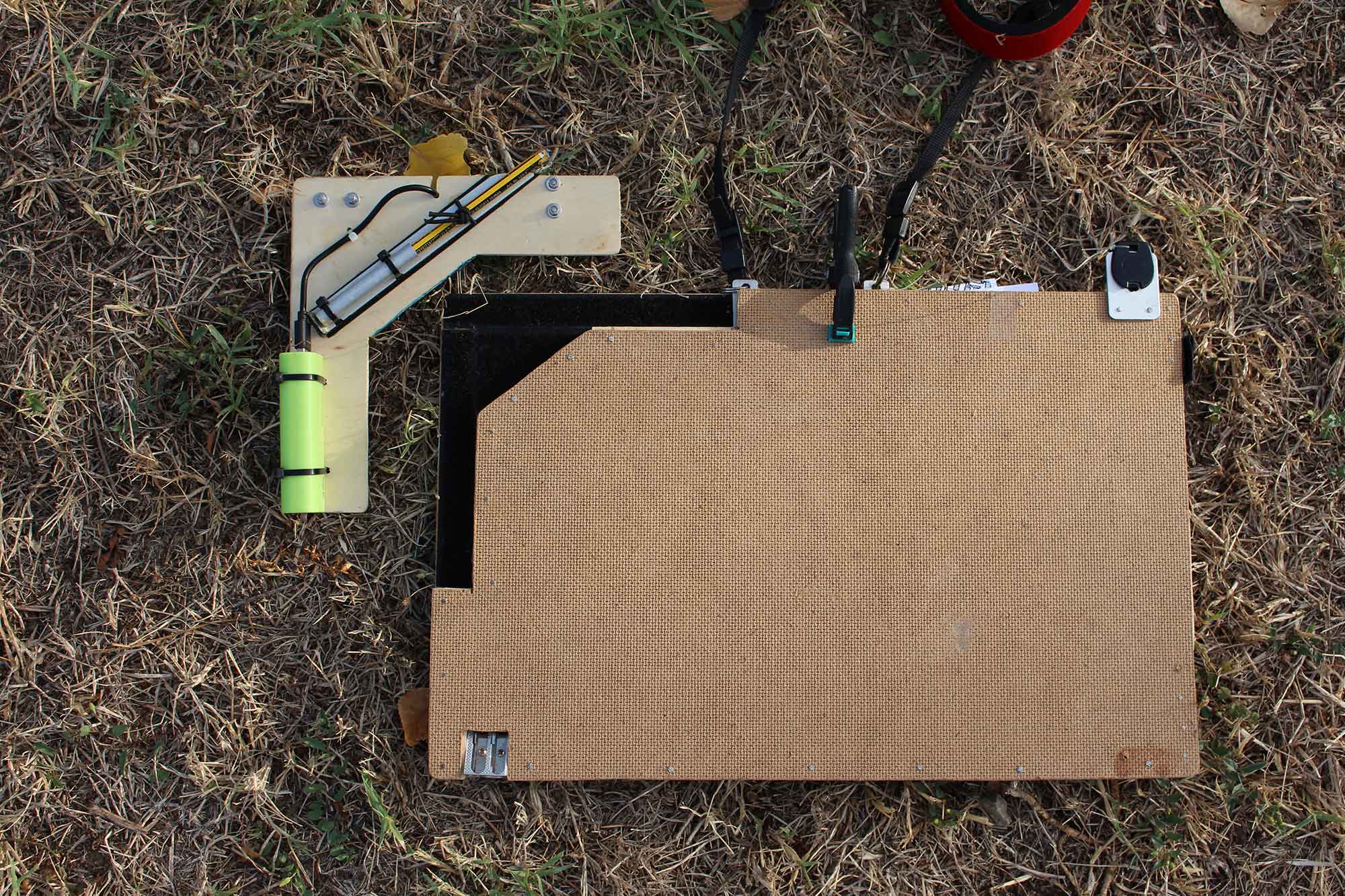
Power supply: 3000 mA power bank.
Autonomy: 10 hours approx.
Construction material: MD chipboard, plywood.
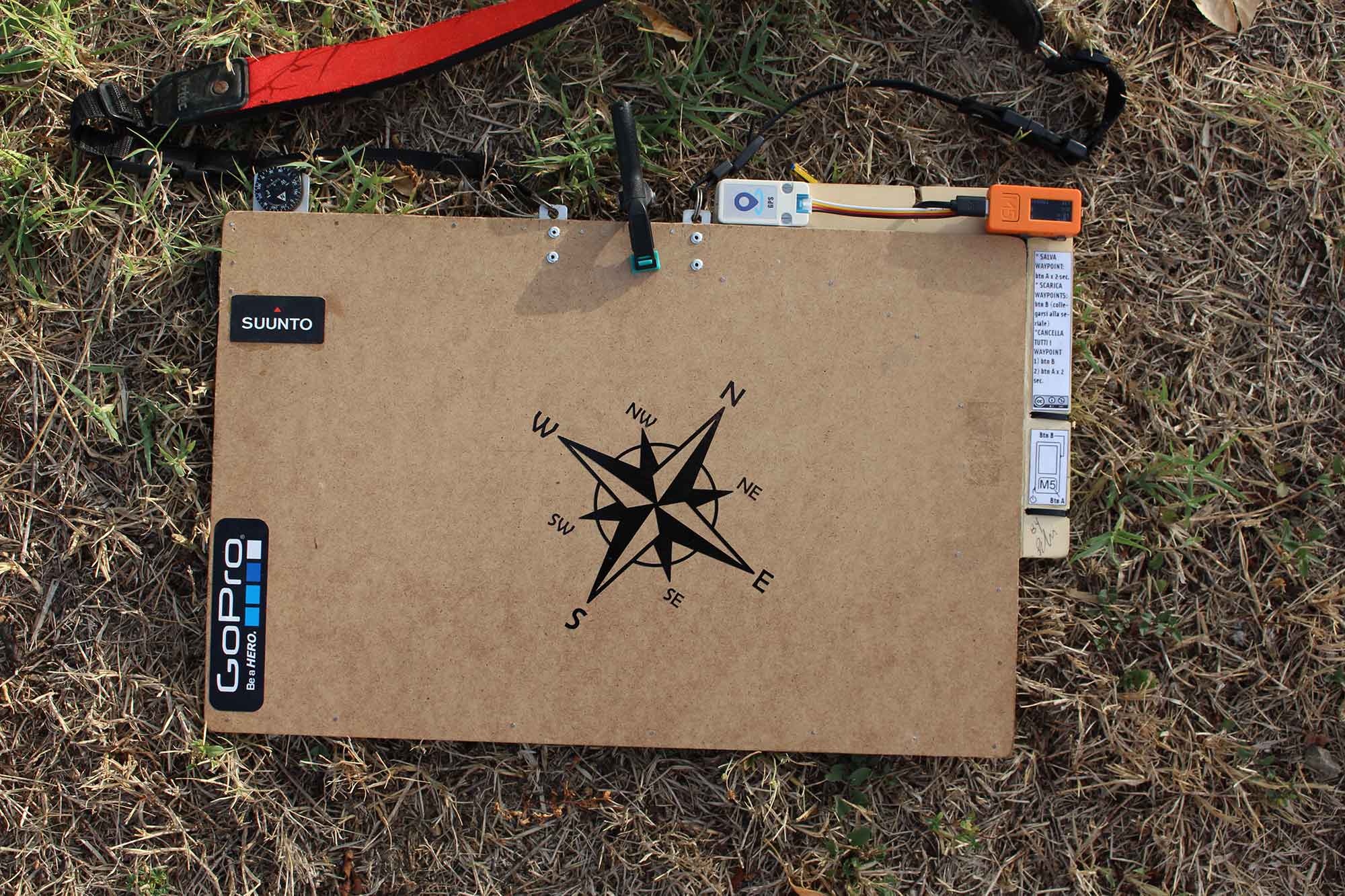
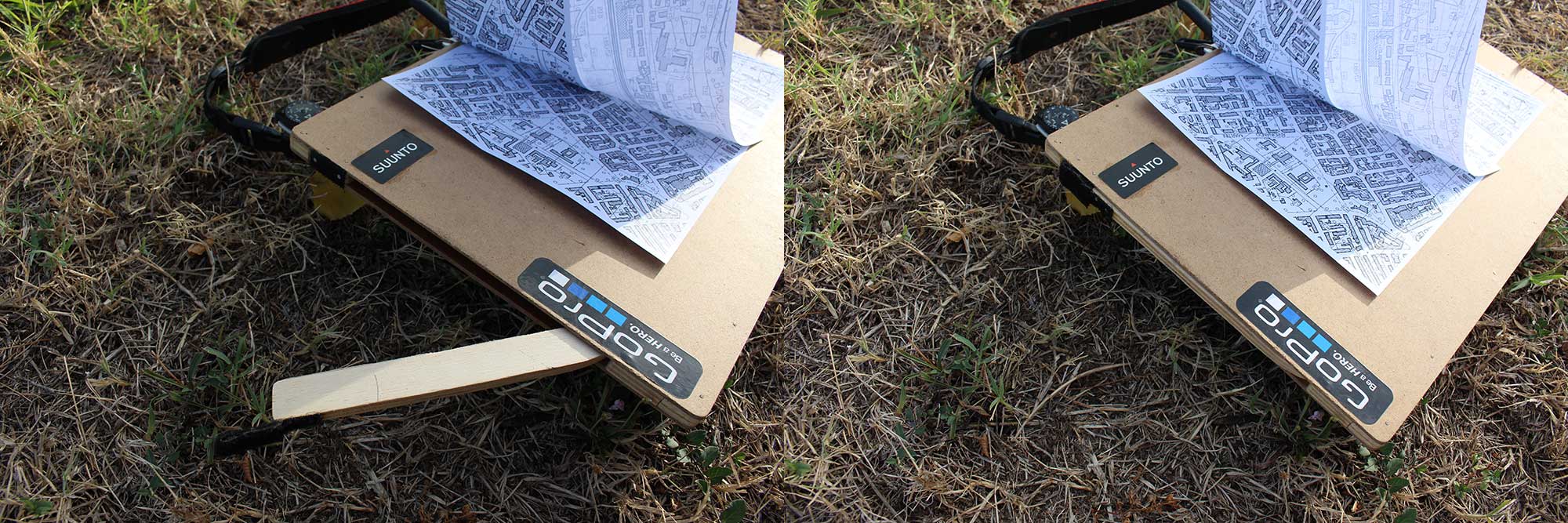
Built-in accessories: pencil sharpener, Suunto compass, pencil holder, shoulder strap